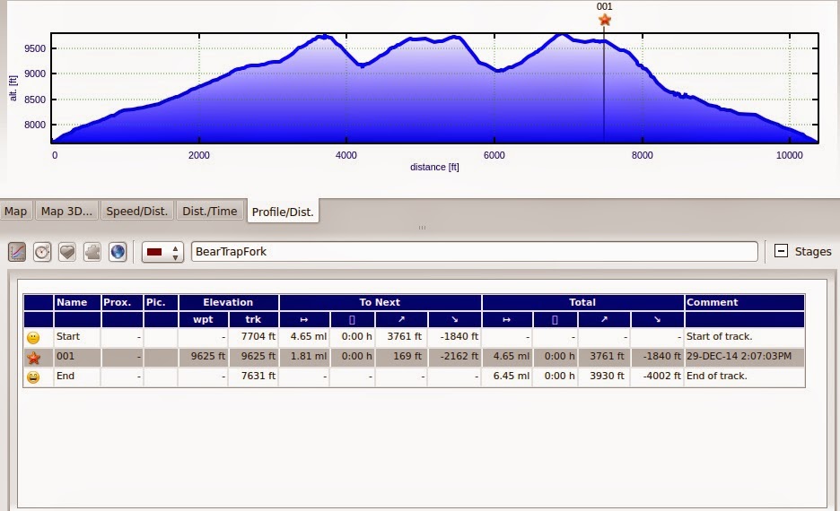
Elevations:
Min: 7631 ft Max 9793 ft Ascent: 3930 ft Descent 4002 ft
Total distance skied: 6.5 miles
The files and videos here are small and low resolution. The videos are flash format. If you want to download the pictures or videos in native format (jpg & mp4) and full resolution please click here.
| Lin |
| Erik |
| Trox |

| 
|

| 
|

| 
|

| 
|

| 
|

| 
|
 |
 |
 |
 |
 |
 |
 |
 |
 |
| From Spot |
 |
| Tracks from Garmin by BaseCamp Clicking this map will leave this page and take you to Google Maps |
 |
| From Garmin - generated by Landkarte |
 |
| BaseCamp Profile |
 |
| Landkarte Profile |